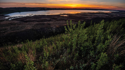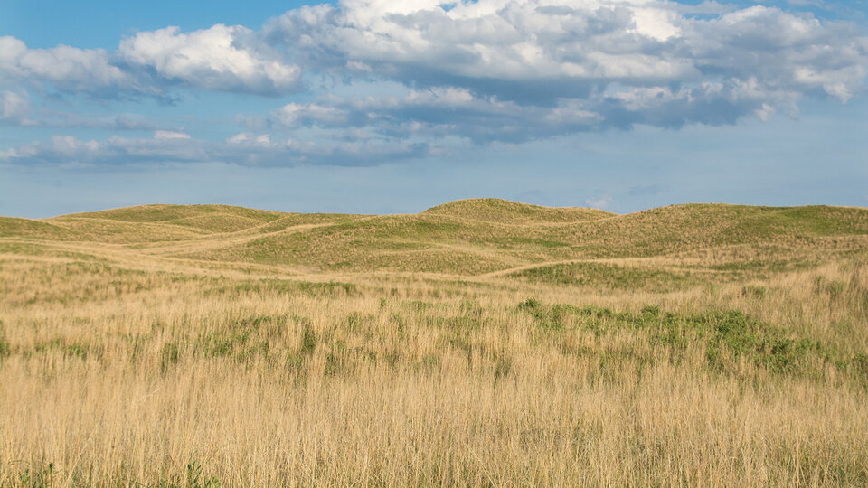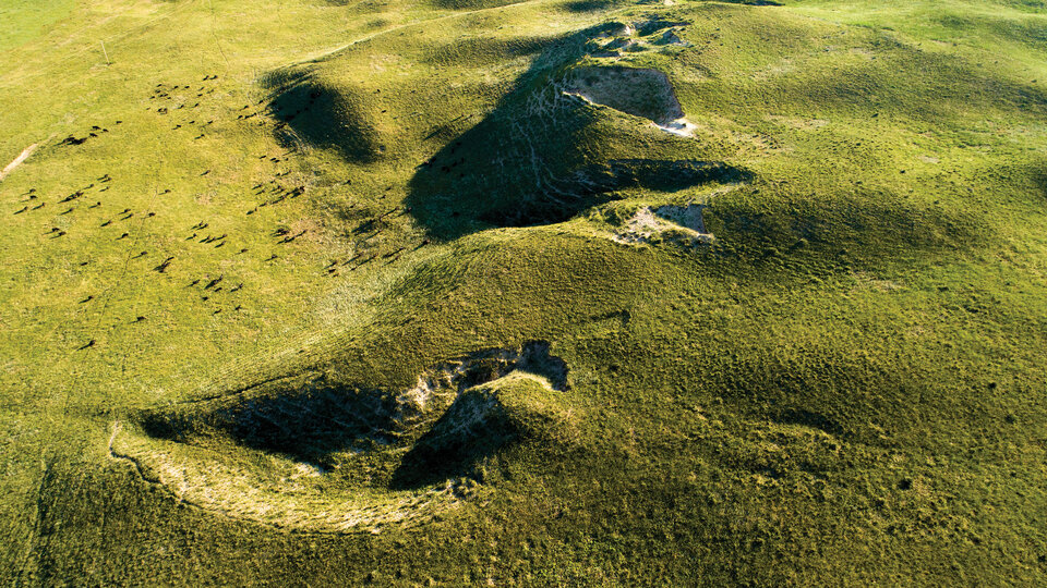

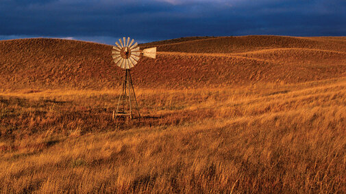
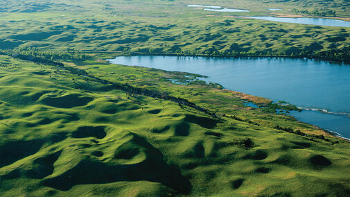
The Nebraska Sandhills features nearly forty essays about the history, people, geography, geology, ecology, and conservation of the Nebraska Sandhills.
Illustrated with hundreds of remarkable color photographs of the area, this is the most up-to-date and illuminating portrayal of this remarkable yet largely unknown region of the United States.
Dedicated to all persons, past and present, who have lived and traveled the Nebraska Sandhills. Our hope for the region’s future rests with those who respect its unique land and spirit.
The authors humbly and specifically acknowledge that the Nebraska Sandhills are situated within the ancestral and current homelands of a number of Indigenous nations, including but not limited to the Pawnee, Ponca, Omaha, Dakota, Lakota, Nakota, Arapaho, and Cheyenne Nations.
Foreword and Introduction
Foreword & Introduction
Foreword
Introduction
- "Introduction to the Nebraska Sandhills", by Mary Harner
- "A Kingdom of Grass: The Nebraska Sandhills", by Michael Forsberg
- "An Abandoned Stone Schoolhouse in the Nebraska Sandhills", by Ted Kooser

A Sense of Place
Part 1
A Sense of Place
- "Tantalizing Clues as to Indigenous Peoples’ Lives in the Sandhills", by John R. “Rob” Bozell and Courtney L. C. Ziska
- "Humphrey Site Reveals Apaches’ Presence", by John R. “Rob” Bozell and Courtney L. C. Ziska
- "The Turtle at the End of the World", by Roger Echo-Hawk
- "Skidi Pawnee Mythic Journey", by Roger Echo-Hawk
- "Cheyenne Sanctuary: The Northern Cheyennes’ Exodus, Mari Sandoz, and Lost Chokecherry Lake", by Emily Levine
- "Settlers: Ranchers, Homesteaders, Immigrants", - by Andrew S. Pollock
- "The Black Homesteaders of DeWitty", by Richard K. Edwards
- "Town Life—A Photo Essay", by Mark Harris
- "Nebraska’s Human-Made National Forest", by Carson Vaughan
- "Is the Experiment Over?", by Kim Hachiya
Land
Part 2
Land
- "Physical Setting of the Sandhills in Maps", by R. Matthew Joeckel, Clayton L. Reinier, Paul R. Hanson, Jesse T. Korus, Troy Gilmore, and Aaron R. Young
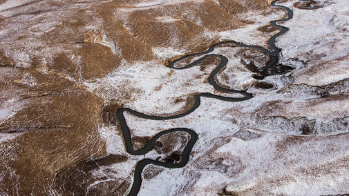
- "The Sandhills through Time", by David Loope, James Swinehart, and Joe Mason
- "What It Takes to Form a Giant Dune Field", by David Loope, James Swinehart, and Joe Mason
- "Sandhills Soils: Interactions among Topography, Water, Sand, Vegetation, and Grazers", by Martha Mamo
- "The Last Five Million Years of Grasslands and Grazers", by Chris Widga
- "Where the Buffalo Roam . . . or Not", by Chris Widga
- "Sandhills Grassland, Large Grazers, and Conservative Use", by Al Steuter
Water
Part 3
Water
- "Groundwater: How the High Plains Aquifer Shapes the Sandhills", by Erin Haacker
- "Sandhills Streams and Rivers as Influenced by Groundwater, Climate, and Humans", by Jessica Corman and Troy Gilmore
- "The Niobrara: A National Scenic River", by Jessica Corman and Troy Gilmore
- "March 2019 Floods", by Jessica Corman and Troy Gilmore
- "Sandhills Lakes in Space and Time", by Sherilyn C. Fritz
- "Sandhills Alkaline Lakes", by David D. Dunigan
- "Diverse Groundwater-Fed Sandhills Wetlands", by Ted LaGrange
- "Fens", by Ted LaGrange and Gerry Steinauer
- "A River in Motion: Platte Basin Timelapse", by Michael Farrell, Michael Forsberg, Kim Hachiya, and Mary Harner
Climate and Weather
Part 4
Climate and Weater
- "The Times They Are A-Changing: Seasonal, Inter-Annual, and Long-Term Variability in Sandhills Temperature, Wind, Rain, and Drought", by Martha Durr
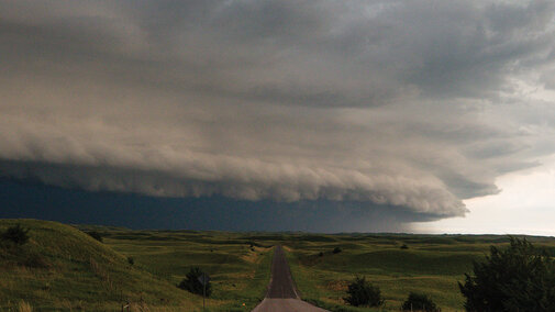
- "How and Why Storms Form in the Sandhills: Location, Location, Location", by Adam Houston
- "Storm Chasing", by Adam Houston
- "When Too Much Rain Is the Problem: 2019 and the Flooding of the Sandhills", by Bethany Johnston
Sea of Grass
Part 5
Sea of Grass
- "The Unique Diversity and Habitat Structure of Sandhills Grasslands", by Chris Helzer
- "Are the Sandhills Resilient or Fragile?", Chris Helzer
- "Sandhills Prairie", by Gerry Steinauer
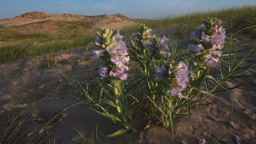
- "Blowout Penstemon", by Cheryl Dunn
- "Grazing Management for Beef Production and Wildlife Habitat", by Walt Schacht and Larkin Powell
- "Grazing, Landscapes, and Greater Prairie-Chickens", by Walt Schacht and Larkin Powell
Wildlife
Part 6
Wildlife
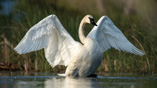
- "Birds of the Sandhills". by Larkin Powell
- "Wilson’s Phalarope", by Larkin Powell
- "Long-Billed Curlew", by Larkin Powell
- "Nematodes of the Sandhills", by Thomas Powers
- "Sandhills Inconspicuous Mammals Make the Region Unique", by Shaun Dunn
- "Kangaroo Rats’ Habits Enhance Plant Diversity", by Keith Geluso and Jeremy A. White
- "Sandhills Sweet Water Lakes Are Productive Fisheries", by Daryl Bauer
- "Common Carp: Invasive Scourge", by Daryl Bauer
- "Herpetofauna Adapt to Sandhills Idiosyncratic Landscapes", by Dennis Ferraro
- "Blanding’s Turtles: Sandhills Smileys", by Ashley Forrester
- "Diverse Landscapes Enrich Insect Diversity and Numbers", by Jeffrey Bradshaw
- "American Burying Beetle", by Steve Spomer
- "Giant Skipper", by Steve Spomer
- "Sandy Tiger Beetle", by Steve Spomer
Ranching
Part 7
Ranching
- "Ranching through the Seasons: Planned for the Worst, Hoped for the Best", by Sarah Sortum
- "Leopold Conservation Award Winners", by Douglas A. Norby
- "Irrigation in the Sandhills", by Jerry Volesky
- "Rotational Grazing and Sustainable Grasslands", by Jim Jenkins

Future of the Sandhills
Part 8
Future of the Sandhills
- "Sandhills Task Force", by Shelly Kelly
- "Eastern Redcedar", by Shelly Kelly
- "Economy, Ranching, and Ecotourism in the Sandhills", by Richard K. Edwards and Katie Nieland
- "World-Class Golf Courses", by Douglas A. Norby
- "Demographics of the Sandhills Over Time", by Dennis Bauer
- "Local Knowledge and the Future of the Sandhills", by Mary Ann Vinton and Jay Leighter
- "Alternative Futures of the Sandhills", by Craig Allen and Caleb Roberts